 |
|
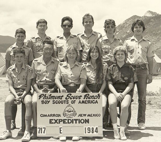
Buffalo Trail CouncilPhilmont Scout RanchCrew 717 E 1984By Tom Florer
This trek was a moderately difficult route through Philmonts beautiful South and Central Country. Ranger training took place at Rayado River, after which we proceeded to Toothache Springs Camp, on the side of Uracca Mesa. From Toothache, we sidehiked over to Uracca Camp to participate in their program, which at the time was Mountain Search and Rescue. Our ranger carried a dutch oven back over to Toothache, so she could make the traditional ranger cobbler. The next morning we made our way to Crater Lake to participate in the Continental Tie & Lumber Company program. After program, we made our way up the long climb over Fowler Pass, then down to Lower Bonita Camp for the night. We spend the evening playing Red Rover in the meadow. The next morning found us heading over Webster Pass, then down to the bottom of Rayado Canyon and Fish Camp. Two things happened here- being Fish Camp we had to tie some flies, and we also had to do a side hike up to Phillips Junction for a food pickup. Fish Camp was not our destination for the night we still had to reach Apache Springs. Its an easy hike in the upper reaches of Rayado Canyon, until the trail makes an abrupt turn and heads to the top of the ridge. Today, this short but steep section of trail is known as the Seven Steps, but back in the early 80s it was known as the Seven Switchbacks of Doom. Apache Springs was our layover camp- no hiking the next day! We got to sleep late, cook a hot breakfast, and leisurely take part in the program, which centered around the Jicarilla Apache Indians. A highlight of the day was watching the sunset from the fenceline on Philmonts western boundary. Crooked Creek was the destination for the next day. We have another food pickup, so we must swing through PJ en route to Crooked Creek. In todays world, Crooked Creek is a staff camp, but in the early 80s it was not. Fur trapping was the program at our next stop- Clear Creek. Is the temperature ever warm at Clear Creek? It was cold and rainy today, and almost every time Ive been there since then its largely the same. Its a great camp, though. The crew gets up early the next morning, and is hiking before sunrise. It will be a long day, as we will climb Mt. Phillips- at 11,711 its the second highest peak on Philmont. Views from the summit include just about all major Philmont peaks, including Baldy. You can also see the highest point in New Mexico- Wheeler Peak, and the Angel Fire Ski Area. Shortly after leaving the summit, we go over Comanche Peak (third highest on Philmont), then start the knee-pounding descent to Cyphers Mine. Cyphers is unique in that you dont have to set up tents- you stay in Adirondack-style shelters. The program is centered around mining, and the mine tour is always a hit. The evenings campfire (known as the Stomp) has always been one of the best on the ranch. The next day starts with the long trek down the North Fork of Cito Creek. This is not one of the best trails on the ranch, crossing the creek over 40 times in just over four miles. This trail was actually closed during the late 80s, and crews had to take the less adventurous route through the Middle Fork of Cito Creek. The North Fork trail was one of the Conservation Project sites during the summer of 05, and has been reopened. Our destination is Schaeffers Pass. Along the way, we stop at the Cito Reservoir to check out the Ice Caves, then again at Clarks Fork to participate in the Western Lore program. There is no water at Schaeffers, so we must carry extra water with us. Waking up the next morning at Schaeffers Pass, we have one last big climb ahead of us. The last 600 to the top of Shaeffers Peak is a grunt (the old trail has since been replaced with one that is actually quite nice). From the peak, its a long traverse across the spine of Tooth Ridge to the base of the Tooth of Time. Of course we had to side hike to the top of the Tooth, then after a quick lunch we cruise the last 3 ½ miles down into Base Camp. |